© IIED
Lying in the valleys of central Mexico, León - with its 2.1 million residents - has experienced significant population growth in the last decade. As the most populous city of Guanajuato state, it is one of Mexico’s top 10 cities regarding population and economic contribution. Traditionally being an important stop on trading routes, León has a rich history of leather manufacturing, with agricultural, tourism and commercial services making up a large portion of economic activity. León is one of the five Latin American cities involved in the Transformative Urban Coalitions (TUC) project and WRI México is the implementing partner in this city.
The city has a temperate climate with rainy summers. León is vulnerable to extreme temperatures, including heat islands, droughts and fires. These conditions cause stress on water supplies and are compounded by flooding, heavy rains and cyclones which cause further risks for food production.
Despite its relatively prosperous economy, there are areas of León experiencing social inequality and poverty where there is insufficient infrastructure and services. Moreover, it experiences several other issues stemming from its economic activity. These include air pollution, water pollution, stress on groundwater sources, soil erosion and contamination, deforestation in protected natural areas, deterioration of green areas, loss of biodiversity and urban sprawl. Increasing greenhouse gas emissions worsen these issues - with energy and transport being the biggest contributors. Progress to tackle issues is slow, funding is a challenge and there is little monitoring and evaluation of goals to improve conditions.
The León Urban Laboratory is testing new ways for people who know and understand the city to get involved in designing projects that can mitigate climate change, increase resilience and reduce inequalities.
The León Urban Laboratory is working to realize a shared vision of transformation that would deliver an orderly, compact, resilient and equal city, whilst improving air quality. The project garnered political support from both the municipal and state governments at inception in 2019. The Lab convened ten workshops, running from May to August 2023. Around 40 diverse participants were involved, coming from both state and municipal authorities, civil society, academia and business.
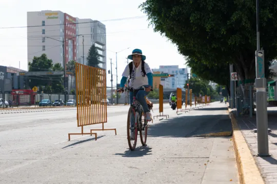
Through these workshops, an ‘urban transformation polygon’ was identified by the Urban Lab participants. This is a central zone of the city that faces multiple challenges such as air quality, active mobility and underutilized land, where urban transformation could be triggered. The selected area is bisected by Adolfo López Mateos Boulevard, one of the city’s main avenues. It connects some of León’s most prominent areas, including Zona Piel (the leather district) and Distrito León, an urban facility that includes the Explora Park, a science museum, the soccer stadium amongst other amenities and housing. Whilst this area is home to Mexico’s first Bus Rapid Transit line and an international bus terminal, the walking and cycling provision is insufficient to meet the needs of the population.
The urban transformation polygon was identified through the following process:
An initial participatory diagnostic mapping exercise was carried out to identify the main urban and environmental challenges for the urban area of León. These problems were sorted into four main categories - environmental, urban planning and housing, mobility and public services.
Using the World Cafe methodology, the participants were divided into four working tables and participated in rounds of discussions, allowing everyone to contribute observations to the maps.
The WRI team digitally systematized the information received through this participatory mapping and a total of 122 different challenges and opportunities were identified and categorized with the highest number of issues identified in the urban planning and housing category.
The information was then processed in a GIS platform. Heat map analysis was performed to determine the density or concentration of issues in a specific area, identifying zones or clusters with higher density. The analysis of heat maps indicated a ‘red zone’ with the highest concentration of challenges, between Boulevard Adolfo López Mateos and Vicente Valtierra. The main identified problems in this area are related to traffic congestion, limited accessibility, conflicts in the distribution of public space, heat island effect, demand management, and pollution.
Whilst two other zones exhibited a high concentration of issues and opportunities, participants decided to concentrate the following sessions and stages of the project only in this 565-hectare space of Zone 1 Centro.
This zone concentrated 70 out of the 122 transformation opportunities identified in the participatory mapping. Additionally, it is the zone with the greatest spatial access to facilities, density of economic units, population density, and housing. It is also the zone with the fewest trees per block, a higher degree of social marginalization, and a greater number of medium and long-term projects labelled by the city government, according to the conducted analyses. There are also air pollution hazards and areas prone to floods and waste accumulation according to the Municipality of León's Risk Atlas 2021.
The next step in defining the precise boundaries of the urban transformation area within the polygon was to incorporate sociodemographic and urban environment criteria into the analysis to prioritize areas that require action to reduce emissions and social inequalities. A final categorization of criteria to delineate the zone included:
- Concentration of identified challenges and opportunities mapped
- Sociodemographic dimension
- Urban environment dimension
- Climate perspective
- Reduction of inequalities
- Maximum distance of 2km - to make it a walkable polygon
- Delimitation based on main and/or continuous roads
- Urban project opportunities underway or planned in the city
Once the zone had been identified, the final step in the process was a ‘recognition fieldwork’ of the transformation polygon. The objective of the fieldwork was to begin to define the transformational image of the zone.
Once the Urban Lab participants had defined a common vision for the polygon to 2030, they then elaborated on short-, medium- and long-term action plans to deliver it. A final action plan was agreed upon. Building a vision to 2030 of the area with low traffic, vibrant public spaces with adequate ‘blue-green infrastructure’, energy-efficient buildings and a circular, local economy that could build a sense of community and identity for residents.
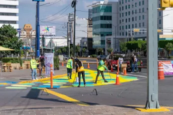
An integrated and inclusive urban street design is required to encourage León residents to walk or cycle instead of driving. Measures are intended to (a) improve public space and infrastructure, including better walking infrastructure and more kilometres of connected bike lanes; (b) be responsive to the specific weather conditions of the city by, for example, increasing the coverage of trees on sidewalks to provide shade; and (c) take into account and tackle existing inequalities in the access to urban mobility and urban facilities.

